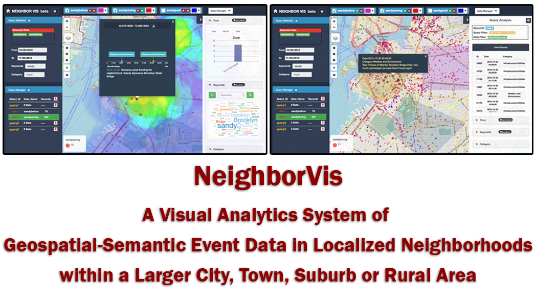
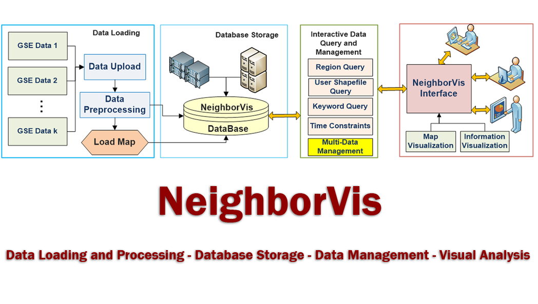
NeighborVis is a visual analytics system of geospatial-semantic event data in localized neighborhoods within a larger city, town, suburb or rural area. The geospatial-semantic event data (we name it GSE data in this document), consists of geospatial (longitude/latitude or locational address), time, and semantic dimensions, which forms a large part of the important information people deal with for business, personal and administrative use. Here are some GSE data examples:
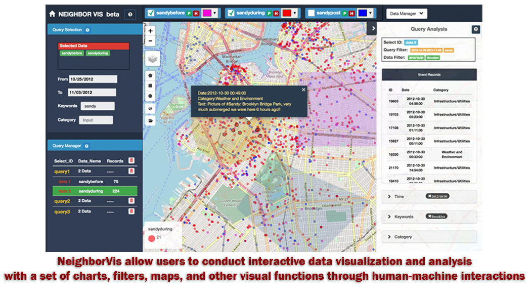
NeighborVis is developed to allow users to study these GSE datasets in a community neighborhood. It is developed to answer the simple questions about a community, such as: what is happening at this location, is it good or bad, and can outcomes be improved? It may be a police department considering a blighted street, a planning department considering urban renewal and the “greening” of spaces, a community group wanting to add neighborhood gardens, or a hospital mining its child injury data. A large variety of users, such as real estate analyzers, public health and safety administrators, business planners, and social scientists, are enabled to conduct exploratory study through an integrated interface of maps, charts, semantic, and information visualization tools, while a set of fluent user interactions are incorporated around the way user think, feel and behave. The visual analysis is easily conducted over fine-grained geographical resolutions such as small neighborhoods around local restaurants, churches, or schools with the provisioning of temporal, semantic and geographical filters and constraints. NeighborVis can greatly help users from multiple sectors including business, finance, public services, social research, and local governments by leveraging the advanced computation and visualization capabilities to utilize their large, complex, and rapidly accumulating community data.
A local version of NeighborVis is freely accessible HERE with the BSD licenses. A guideline of usage can be accessed HERE.
 This project is supported partially by National Science Foundation grant CNS-1637242.